Reregulation Dam to Hwy 70 (3 miles) (Lower Mountain Fork or LMF)
| Usual Difficulty |
I-II+(IV) (for normal flows) |
| Length |
3 Miles |
| Avg. Gradient |
10 fpm |
| Max Gradient |
45 fpm |
 Photo of Jordan Egan by David McDonald taken 8/2006
Gauge Information
River Description
Located in extreme Southeastern Oklahoma, the Lower Mountain Fork River below the Reregulation dam is a popular summer recreation spot. At medium flows, this is an excellent river for learning and developing basic whitewater skills. Water quality in this clear, rocky stream is very good, with water temps kept at or below 70 degrees to support a healthytrout poulation.
After leaving the campground at the putin, you won't see any signs of development until you come to the old iron bridge at the takeout. On busy weekends during the day, you will most likely see plenty of rental carnage, with the Rock Garden, Chute and Presbyterian Falls areas being some really good places to "kick back and watch the show." After 4 or 5:00 though, this usually changes. All the rental boats are gone, and the "release water" often starts showing up. Beautiful scenery, solitude and much better flows is what you will often experience then.
Minimum flows in the 120 - 200 CFS range make this section of river popular with beginners and will be really bony in spots, especially through the Rock Garden. Releases that are usually scheduled late in the afternoons during the hotter months can change the character of the river quickly and dramatically. In the drier months of the year stream flows above about 120 CFS depend upon the number of hydroelectric power generators (there are two) running and the length of time they run. Generally speaking, one generator running for three hours can produce roughly 500 - 1000 CFS, slowly dropping back after the crest. This is dependent upon how much water was behind the reregulation dam prior to release. Two generators for a similar period of time can produce 2-3000 CFS.
(Generation / streamflow ratios given as a rough guide only).
At flows of 2000+ the river exceeds the class 2+ rating and runs should not be attempted by paddlers without at least strong intermediate whitewater skills. Longer generation times will result in higher peak flows, with extended 2 generator releases easily producing flows of 4000 - 7000 CFS.
Caution!
High flow rates typical of extended two generator releases can produce nasty hydraulics, pushy water conditions and dramatically increased chances for pinned boats,(especially true for open canoes without flotation, which can easily be wrapped and broken) long swims, lost equipment, and plenty of other hazards. Routes can become difficult to find and winding up in flooded timber is possible. Class IV rating given at high levels to reflect these consequences. This is especially true in the Chute and Ledges sections just above Presbyterian Falls, the keeper hole that forms at Presbyterian Falls, and the low-lying wooded area about a half-mile upstream of the takeout that floods out at higher levels.
Normally, especially during the summer months, the river falls into the 120-300 CFS range before the releases, making it suitable for beginners in kayaks, canoes, float tubes, you name it - you will probably see it there. This is a very popular river and home to a number of liveries, and can become quite congested on weekends during the day. However, most liveries stop putting in between 3 and 5pm most days, avoiding the peak flows of the releases. Evenings usually find the river with higher flows and a much less boat traffic, making it seem like a totally different river. Intermediate to advanced boaters tend to enjoy this time the most. Two generator releases in the evenings can hold the river to levels above 1000 for several hours after the generation has stopped - sometimes until noon and beyond the next day.
Each summer, due to the consistent flows, Swiftwater Rescue Training Classes are held here. These ACA classes instruct participants in techniques for river safety, self rescue, and rescue of other paddlers and equipment. Contact Jim Simmonsfor more information. (See photos below.)
Putin
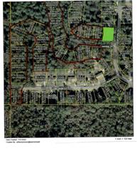
From intersection of US259 & US70 in Broken Bow go East on 70 5.2 miles. There is a sign on the south side of 70 that says "Mountain Fork Park". Turn left and you will see a sign that says "Canoe Rentals". Go north on this road 3 miles to the putin which is located within the campground.
Takeout
Takeout is located at the Mountain Fork River at Hwy70 - 1.8 miles East of Mountain Fork Park Road. Cross over the iron bridge, and take then take a left on the dirt road that will parallel the north side of the road. Park directly under or near the bridge. Please don't park on the outfitter's lot on the south side of the bridge.
Camping
There are 12 improved campsites available at the putin. All 12 have concrete picnic tables, lantern posts, fire rings and water. Some of them have electricity and can accommodate most full-size RV's. Fees range from $15.00 a night for full RV sites to $8.00 a night per tent for primitive camping, which is also available here. There are no showers at the Rereg campground, but there is a vault toilet there. All campsites in this park are available only on a first come - first served basis. This campground fills up quickly on most spring, summer and fall weekends, and particularly on holidays. Also, Beaver's Bend State Park, located on the flatwater section of the river between Broken Bow Lake dam and the power plant has lots of campsites, cabins, showers, and other services available. Your camping receipt from the Rereg campground entitles you to use the showers, etc. at Beaver's Bend. There are other campgrounds available in the Broken Bow Lake area as well as primitive camping in the adjacent Ouachita National Forest.
Other Nearby Accommodations and Services
There are several outfitters in the area providing kayak and canoe rentals, and shuttles. Some have stores offering items you might need for a day on the river. There are lots of private rental cabins all around this area, too.
Broken Bow has motels, stores, gas stations, cafes & restaurants, and just about anything else you might need. If you forget or run out of something you can always make the short drive down to Broken Bow. There is also a convienience store with gas at Eagletown, a few miles east of the takeout bridge on US70 that is a little closer than Broken Bow if you need to just pick up a couple of things.
StreamTeam Status: Not Verified
Last Updated: 2006-10-04 01:04:27
Editors
Rapid Summary
Rapid Descriptions
Rock Garden (Class II, Mile 0.1)
Boulder garden with ledge drop water falls. Features a couple of tight turns at medium flows that require some quick maneuvering. At flows of 400-2000 there are a few small play spots here. Rock Garden washes out under extended two-generator releases.
The Ledges (Class II+, Mile 0.8)
Big Ender
 Big Ender Big EnderPhoto of Heath Day by Amber taken 10/15/05
This route is an alternative to The Chute and runs parallel to it. Stay to river right after the Rock Garden to run The Ledges. The Ledges are very bony at low levels, and not really worth the trouble at levels less than 400cfs. At levels above 400 the action picks up and and offers technical rapids, ledges and pourovers. At higher levels several good surf spots and playholes develop. There are three main rapids (and numerous smaller ones) in this section. At first, this route winds through boulders, small islands, Cypress trees, Cypress knees, and low hanging limbs. Very scenic. Go through that stuff and then you will come to a small rapid to the right that will flatten out some before the next drop. The crosscurrents in this area can be a little tricky at higher flows.
The first main rapid is 1100 Springs. Enter to the right,down the ledge, avoid the boulders, and make a quick left to go through the wave train. Good surf spot at levels above 1000, but can be played at 400+. This is a good place to learn how to surf at medium levels. The water flattens out again here and there will be several rapids coming in from the left. At the right levels there are some small small holes/rapids to play in. Another good learning spot.
Next is the rapid above Bubba. Nice waves form over 1000, stop and surf a while. Quick ferry to river right will put you on the line for Bubba. Go just to the right of the large boulders. Or you can continue straight down the wave train and over the ledge left of Bubba for a more technical run. Try not to swim here.
Bubba is the hole below the pourover on the last ledge before Presbyterian Falls and is a popular playspot. At low levels the hole is deep and not very friendly. At 400+ it can provide quite a lot of action. Lots of submerged rocks in this area - use caution.
The Chute (Class II, Mile 1.0)
Stay to river left to run The Chute, a tight fast chute dropping 15' in 1/3 mile. This can be bony at minimal water levels, but picks up to be a nice class II rapid at levels between 300 and 2000. Quick maneuvering can be necessary to avoid several hazards. Low hanging tree in the middle of the first drop can be very hazardous at high levels - stay to the left. Watch for cypress knees throughout the chute as well. Probably one of the biggest hazards to be encountered here are the pinned-up and unmanned rental boats, and "swimmers". (If you don't feel like messing with any of this, then go down the other side,The Ledges -- far fewer renters will go that way). Eddy out on right at end of The Chute before running Presbyterian Falls, or paddle back up to the right to access Bubba.
Presbyterian Falls (Class II, Mile 1.3)
This river wide ledge with 3 foot drop is a popular summer hangout. Run it down the middle. Parking is available to access this feature. A portage trail on river left runs the entire length of the chute to access the top of the chute. From the end of the portage trail at the top of the chute you can also paddle upriver on relatively flat water 500 feet or so to access The Ledges.
Note - Keeper hydraulic forms at the falls at levels somewhere between 2000-4000 CFS.
Leaning Tree (Class N/A, Mile 2.8)
Beyond Presbyterian Falls, the river widens, flattens out and runs fairly straight for about a mile and a half, then becomes channelized and splits around an island at lower levels. Run right of the island through the wide shallow channel. At the end of this channel there is a leaning cypress tree in the middle of the chute that has pinned, wrapped, and broken many canoes and has caused quite a lot of problems for unsuspecting boaters. The higher the river level, the greater the chances for problems here. Most will run the narrow passage to the left of this tree. Whichever route you choose, make your decision as soon as you see the tree and stick to it. Last minute indecision here will likely lead to an unpleasant encounter with the old cypress tree. Note: The island mentioned above will flood out at levels above about 2000, making the route somewhat more difficult to find. Strainers can be a big problem if you somehow end up in here when this area is flooded.
|