Fox Island is a census-designated place (CDP) in Pierce
County, Washington, United States, on an island of the same name in Puget
Sound. It is located approximately five miles from Gig Harbor. The island was
named Fox by Charles Wilkes during the United States Exploring Expedition, to
honor J.L. Fox, an assistant surgeon on the expedition. The population was
3,633 at the 2010 census.
Contents
1 Geography
2 History
3 Demographics
4 See also
5 References
6 External links
Geography
Fox Island is located at 47°14′39″N 122°37′12″W (47.244053,
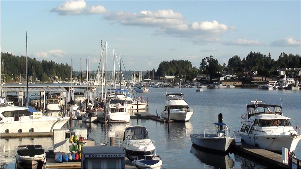
-122.619906).[5] There is a dock on the north side of the island. The waters
around the island are used for fishing and scuba diving.
According to the United States Census Bureau, the CDP has a
total area of 6.4 square miles (16.5 km²), of which, 5.2 square miles (13.5
km²) of it is land and 1.2 square miles (3.0 km²) of it (18.31%) is water.
Fox Island is separated from the mainland by Hale Passage to
the north. To the southwest, Carr Inlet separates Fox Island from McNeil
Island.
History
In 1792, during the Vancouver Expedition, Peter Puget led an
exploration party through southern Puget Sound. After an encounter with local
Indians ended with Puget ordering a musket fired as warning, the exploration
party retreated to Fox Island, where they made camp for the night.
In 1856, during the Puget Sound War, most of the Puyallup
and "non-hostile" Nisqually Indians, totaling about 500 people, were
removed to Fox Island. John Swan was assigned to supervise the encampment and
distribute food provided by the territorial government. On January 5, 1856,
Chief Leschi and other "hostile" Indians arrived at Fox Island with a
flotilla of canoes. Trusting Swan, they had come to talk about the war and how
to resolve it. While the hostile Indians were on Fox Island, Captain Maurice
Maloney took the steamship Beaver to the island, hoping to rescue Swan, but
forgot to bring landing craft and was unable to send men ashore. Before Maloney
could figure out what to do, Swan came to the shore and paddled a canoe to the
Beaver. He told Maloney that there had been no violence, urged him to not come
ashore, and said he had promised to return to the island, which he did. Maloney
returned to Steilacoom and, along with other military officers, took another
steamship, the USS Active from Steilacoom to Seattle to get a howitzer (which
they failed to acquire), then back to Fox Island, hoping to capture Chief
Leschi. But by the time the Active returned, more than 30 hours after Leschi
had arrived on Fox Island, the hostile Indians had left.
By August 1856 the war was essentially over. Governor Isaac
Stevens went to the Indian encampment on Fox Island to renegotiate the 1854
Treaty of Medicine Creek, which had been a major factor in the outbreak of war.
Stevens agreed to new, larger reservations for both the Puyallup and Nisqually
tribes.
The first non-Indians settled on Fox island in 1856, just
after the war ended. One of the first real estate transactions was in 1881 when
56.5 acres (22.6 hectares) were sold for $118. By 1908 there were about 60
homes scattered across the island.
The most important change to this community happened in 1954
when the Fox Island Bridge was completed, connecting Fox Island to the
mainland. This allowed easy access to businesses, schools, and medical
facilities outside the island. In 1956 the population of the island was 120, by
2000 it had grown to more than 2,800.
On April 29, 1988, at 6 PM local time, a nuclear-powered US
Navy submarine, the USS Sam Houston (SSN-609), ran aground on Fox Island while
operating in nearby Carr Inlet. The ship remained aground for approximately 10
hours until high tide returned and tugboats were brought in to unstick the
ship. No damage was done to the island, and the ship entered a drydock at the
Bangor Naval Submarine Base for minor repairs to its hull.
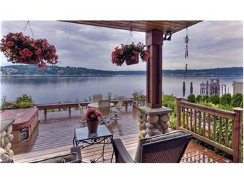
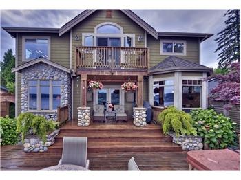
In recent years, Fox Island has become a wealthy suburb of
Gig Harbor and, via the Tacoma Narrows Bridge, Tacoma. This is mostly due to
the amount of waterfront property on the island, in addition to being placed
between the Olympic Mountains and Mount Rainer. A large amount of the islands
residential property have views. Based on per capita income, one of the more
reliable measures of affluence, Fox Island ranks 29th of 522 areas in the state
of Washington to be ranked.
Demographics
As of the census[2] of 2000, there were 2,803 people, 1,048
households, and 847 families residing in the CDP. The population density was
536.3 people per square mile (206.9/km²). There were 1,150 housing units at an
average density of 220.0/sq mi (84.9/km²). The racial makeup of the CDP was
94.08% White, 0.64% African American, 0.75% Native American, 1.64% Asian, 0.14%
Pacific Islander, 0.39% from other races, and 2.35% from two or more races.
Hispanic or Latino of any race were 1.86% of the population.
There were 1,048 households out of which 36.8% had children
under the age of 18 living with them, 72.4% were married couples living
together, 6.1% had a female householder with no husband present, and 19.1% were
non-families. 15.1% of all households were made up of individuals and 4.8% had
someone living alone who was 65 years of age or older. The average household
size was 2.67 and the average family size was 2.97.
In the CDP the population was spread out with 27.3% under
the age of 18, 4.4% from 18 to 24, 25.0% from 25 to 44, 31.8% from 45 to 64,
and 11.5% who were 65 years of age or older. The median age was 42 years. For
every 100 females there were 100.6 males. For every 100 females age 18 and
over, there were 96.0 males.
The median income for a household in the CDP was $69,135,
and the median income for a family was $72,284. Males had a median income of
$61,208 versus $39,821 for females. The per capita income for the CDP was
$32,533. About 1.7% of families and 3.2% of the population were below the
poverty line, including 5.0% of those under age 18 and none of those age 65 or
over.