Broken Bow is a city in McCurtain County, Oklahoma, United States. The population was 4,120 at the 2010 census. It is named after Broken Bow, Nebraska, the former hometown of the city's founders, the Dierks brothers.[3]
History
The land that would become Broken Bow was owned by the Choctaw tribe
prior to being settled by colonizers. Growing around a lumber company
started by two brothers, Broken Bow had a population of 1,983, just a
decade after its incorporation in 1911.[3] The city lies within the Little Dixie region of Oklahoma, an area originally settled largely by Southerners seeking a new start following the American Civil War.
The city was the location of the wounding and capture of murderer Richard Wayne Snell in 1984, following his shootout with local police.[4] Snell had shot and killed two men in Arkansas, a pawn shop owner and Arkansas State Trooper Louis P. Bryant.[5]
Geography
Broken Bow is located at 34°1′47″N 94°44′16″W (34.029784, −94.737656).[6]
According to the United States Census Bureau, the city has a total area of 5.0 square miles (13 km2), of which 5.0 square miles (13.0 km2) is land, and 0.04 square miles (0.10 km2) (0.40%) is water.
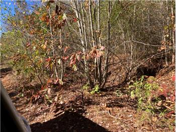
The city of Broken Bow stands in a unique transition zone between the Red River basin and the Ouachita Mountains.
While the Ouachita Mountains are sandstone ridges that are considered
the roughest land in Oklahoma, the Red River basin is considered
fertile.[7] North of Broken Bow is Broken Bow Lake, created by the United States Army Corps of Engineers by damming the Mountain Fork River.[3] The lake's creation forced Hochatown to relocate to its present-day location.
The Broken Bow Lake covers 14,220 acres (57.5 km2) and has 180 miles (290 km) of shoreline.[8] The lake contains small islands, bass and is surrounded by pine trees.[8]
The city sits at the foothills of the Kiamichi Mountains, a subrange of the Ouachita Mountains.[9] the Kiamichi Mountains sit within Le Flore, Pushmataha, and McCurtain counties near the towns of Poteau and Albion.[10] The Kiamichi peaks line up south of the Kiamichi River and reach 2,500 feet (760 m) in elevation.[11] The range is the namesake of Kiamichi Country, the official tourism designation for southeastern Oklahoma.
Black bear, coyote, bobcat, deer, minks, bats, bald eagles, and varieties of woodpeckers, doves, owls, and road runners are native to the Kiamichi Mountains region.[12]
Climate
|
| Climate data for Broken Bow, Oklahoma
|
| Month
|
Jan
|
Feb
|
Mar
|
Apr
|
May
|
Jun
|
Jul
|
Aug
|
Sep
|
Oct
|
Nov
|
Dec
|
Year
|
| Average high °F (°C)
|
51.7
(10.9)
|
56.4
(13.6)
|
65.4
(18.6)
|
74.6
(23.7)
|
81.0
(27.2)
|
88.4
(31.3)
|
93.1
(33.9)
|
93.4
(34.1)
|
86.0
(30.0)
|
76.4
(24.7)
|
64.8
(18.2)
|
54.9
(12.7)
|
73.8
(23.2)
|
| Average low °F (°C)
|
26.9
(−2.8)
|
31.0
(−0.6)
|
39.0
(3.9)
|
48.4
(9.1)
|
56.9
(13.8)
|
64.4
(18.0)
|
68.0
(20.0)
|
67.0
(19.4)
|
61.3
(16.3)
|
48.8
(9.3)
|
39.7
(4.3)
|
30.6
(−0.8)
|
48.5
(9.2)
|
| Average precipitation inches (mm)
|
2.9
(74)
|
3.5
(89)
|
5.3
(130)
|
4.7
(120)
|
6.6
(170)
|
4.3
(110)
|
3.9
(99)
|
3.1
(79)
|
4.7
(120)
|
4.3
(110)
|
4.5
(110)
|
4.1
(100)
|
51.9
(1,320)
|
| Source: Weatherbase.com [13] |